Involve Space

Involve Space

Stratospheric platforms for Earth observation, security and validation

Start-up

Via Antonio Brusa,  69
Canzo  (Como) — 22035 — Italy
Phone +39 031 668 0373

Description

Involve Space is an Italian aerospace company that designs, develops, and deploys intelligent pseudo-satellite platforms for Earth observation, defence, and flight validation.
The company primarily operates dedicated missions and provides DaaS solutions in response to scalable geointelligence requirements.
Involve Space works with NASA, ESA, governments and commercial organisations.
Involve Space targets medium and large enterprises, public authorities, and operators in defence and security, energy, infrastructure, environment, agriculture, and civil protection, seeking advanced solutions for Earth observation, dual-use geointelligence and research. 
Our products

Stratostats and Stratorelay pseudo-satellite platforms

Stratostats and Stratorelay pseudo-satellite platforms

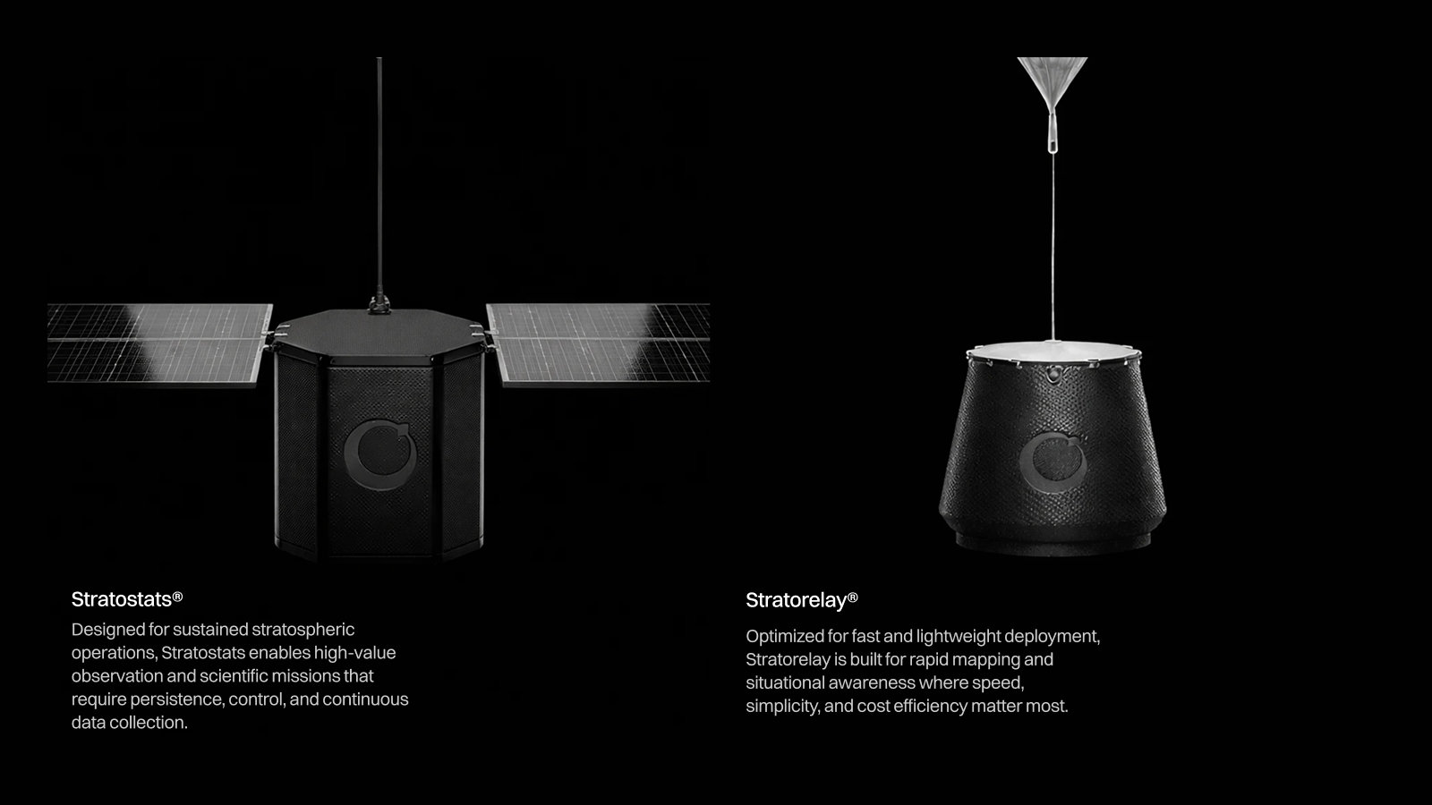
Involve Space pseudo-satellite platforms, Stratostats® and Stratorelay® represent a new generation of Earth observation systems designed to deliver very-high resolution imagery (30 cm/px) with rapid deployment, operational flexibility, and cost-effective performance. Equipped with optical, multispectral, hyperspectral, and SAR sensors, they enable persistent monitoring of areas of interest and real-time intelligence for applications across defense and security, energy, infrastructure, environmental monitoring, agriculture, and civil protection. Stratostats® is designed for long-endurance missions and can operate in the stratosphere for several weeks, providing continuous surveillance and wide-area coverage. Stratorelay®, by contrast, is optimised for rapid deployment and efficient mapping operations, making it ideal for time-sensitive missions as well as the in-flight validation of new materials and scientific experiments. Both platforms are natively integrated with CLEAR, Involve Space’s proprietary GeoAI platform, transforming collected data into actionable intelligence and enabling faster, more informed decision-making.
CLEAR, geospatial artificial intelligence

CLEAR, geospatial artificial intelligence

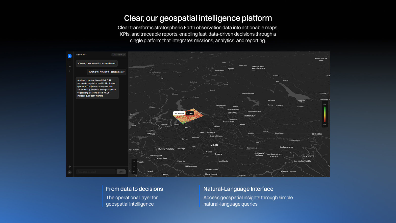
CLEAR is Involve Space’s proprietary geoAI platform, developed to transform complex geospatial data into high-value operational intelligence. By integrating in real time information collected from Stratostats, Stratorelay, and other Earth observation sources, CLEAR leverages advanced artificial intelligence algorithms to detect anomalies, identify changes, and generate contextualised insights. The platform supports faster, more accurate, and better-informed decision-making through automated analytics, intuitive visualisations, and natural language interactions with users. CLEAR is designed for public and private organisations operating in defense and security, critical infrastructure, energy, environmental monitoring, agriculture, and emergency response. Thanks to its ability to process large volumes of data in real time, CLEAR enables organisations to move effectively from observation to action, enhancing situational awareness and supporting both strategic and operational decision-making.

Our video