LOKI
Table n. 54

LOKI

Laboratory Of Key Innovations

Start-up of ITA - Italian Trade Agency

Start-up

Bertola,  12
San Sebastiano da po  (TO) — 10020 — italy
Phone +393760128223

Description

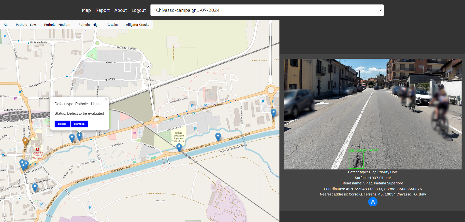
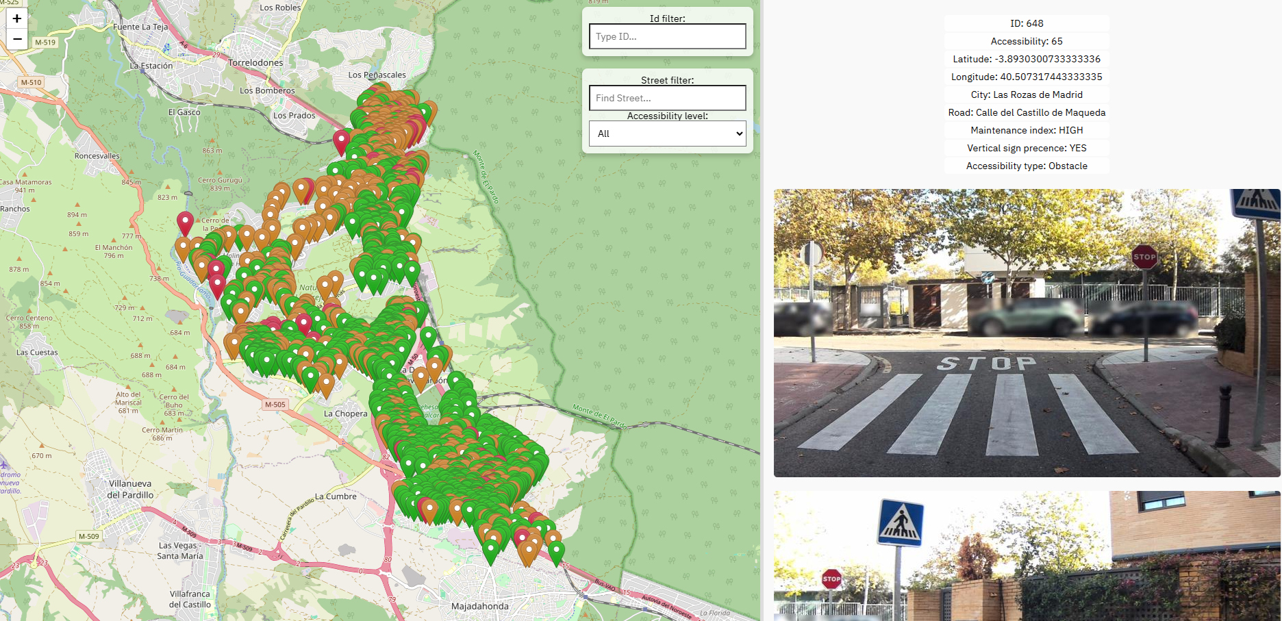
LOKI S.r.l. is an innovative startup revolutionizing road infrastructure monitoring with AI, high-res cameras, and satellite data. The Asfalto Sicuro® system detects, classifies, and geolocates road defects with precision, reducing maintenance time and costs. With predictive analytics, LOKI enables targeted interventions, enhancing safety and urban sustainability.

Our services cater to municipalities, road authorities, maintenance companies, and insurers, providing continuous monitoring and reliable data to optimize infrastructure management, reduce accidents, and cut operational costs.


Our products

Asfalto Sicuro®

Asfalto Sicuro®

Asfalto Sicuro® is an advanced road monitoring system based on AI, GNSS, and sensors. Installable on any type of vehicle, it detects, classifies, and geolocates road defects such as potholes, cracks, and anomalies. It uses high-resolution cameras, IMU sensors, and satellite-based space technologies to provide detailed and predictive insights, enabling targeted maintenance. The system ensures decimetric precision and reliable position authentication. With predictive analytics, it anticipates damage before it becomes critical, reducing maintenance costs and safety risks. The system is managed via an interactive web app, offering detailed maps and automated reports. Designed for municipalities, road authorities, and maintenance companies, it enhances operational efficiency, improves road safety, and promotes sustainable mobility.

AIPECRA

AIPECRA

AIPECRA is an advanced monitoring system focused on pedestrian infrastructure accessibility. It uses AI, GNSS, and sensors to detect, classify, and geolocate crosswalk defects, ramps, and barriers affecting mobility. Installed on any vehicle, it captures high-resolution images and IMU sensor data, integrating space technologies to ensure decimetric precision and accurate positioning. AIPECRA automatically evaluates zebra crossings, sidewalks, and urban obstacles, assigning an accessibility index to guide targeted improvements. Through predictive analytics, it helps cities prioritize interventions, ensuring safer and more inclusive pedestrian pathways. Data is accessible via an interactive web app, providing real-time maps and automated reports. Designed for municipalities and urban planners, AIPECRA enhances mobility for people with disabilities, improves infrastructure efficiency, and supports sustainable urban development.