NETF DRONE
B82

NETF DRONE

Surveys and industrial inspections from a new perspective

Start-up of Regione Abruzzo

Start-up

Pasquale De Virgilii,  2
Chieti  (Chieti) — 66100 — Italia
Phone 3881079439

Description

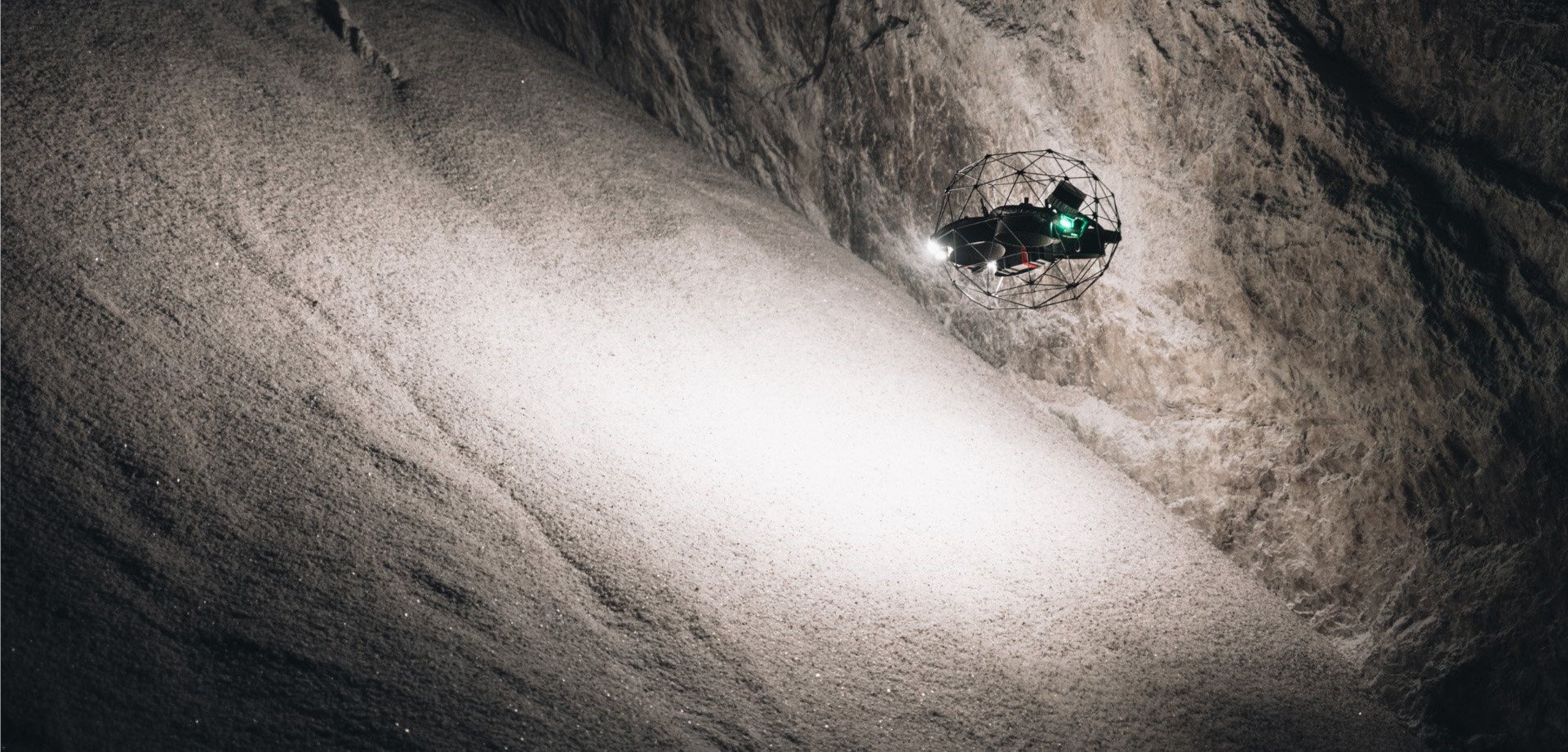
NETF DRONE is a company specialized in surveys, inspections, and monitoring activities using industrial drones in the civil, industrial, and agricultural sectors. We offer advanced solutions for work in both open and confined spaces, aiming to improve safety and efficiency in survey and inspection projects and processes.

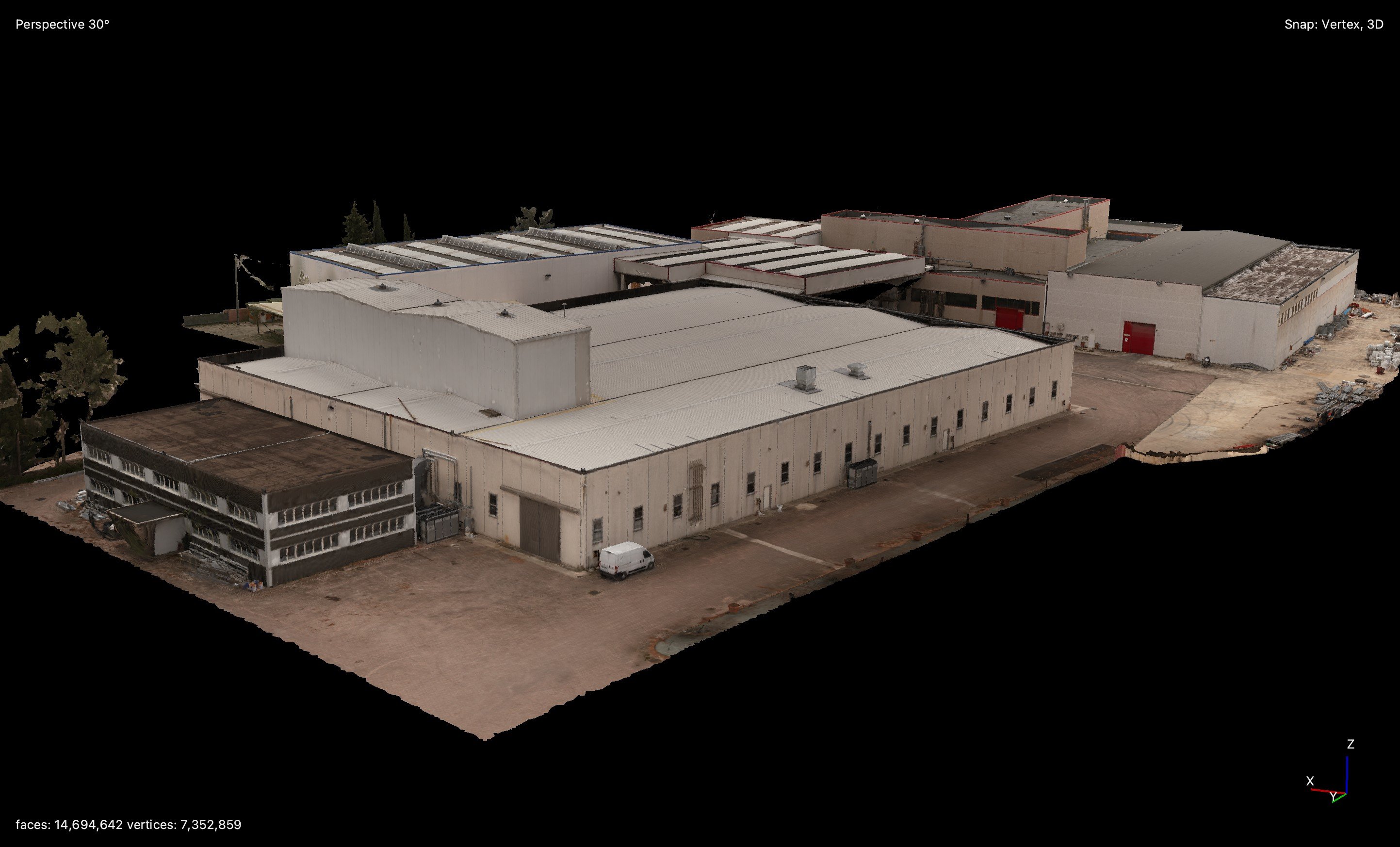
Among our main services, topographic surveys play a fundamental role. We utilize drones equipped with advanced technologies to conduct detailed and precise topographic surveys, providing accurate data for design and territorial planning. These surveys allow us to create digital terrain models (DTM) and high-resolution orthophotos, essential for feasibility studies, engineering design, and environmental monitoring. For subsurface utility detection, we use advanced tools such as utility locators and ground-penetrating radar (GPR), which enable the precise location of pipes, cables, and other structures, ensuring a comprehensive mapping of underground infrastructure.

To further enhance our offerings, we have introduced "Scan to CAD" and "Scan to BIM" survey services. These allow us to convert obtained scans into precise CAD models and implement BIM solutions for integrated and dynamic asset management. Thanks to these advanced technologies, we can provide a detailed and accurate representation of infrastructures and the territory.

Through our inspection and monitoring activities of industrial assets, we are able to detect anomalies by creating Digital Twins, identifying cracks, corrosion, and water infiltration. These services also fall within the scope of preventive and corrective industrial maintenance, allowing us to intervene promptly before any failures can disrupt the production cycle.

Our vision is to achieve intelligent industrial maintenance, leveraging advanced data and modeling to maintain and improve the resilience and efficiency of our clients' facilities.


Our products

Surveys and inspections

Surveys and inspections

Combining experience and technological innovation, we rely on advanced methodologies such as photogrammetry and LiDAR, coupled with the RTK system, to ensure topographic surveys of high precision and detail. Leveraging our expertise, we generate high-quality point clouds, DEMs, contour lines, and orthophotos, offering optimal solutions for feasibility studies, engineering design, and environmental monitoring. For subsurface utility detection, we employ advanced tools such as service locators and ground-penetrating radar (GPR), allowing precise localization of pipes, cables, and other structures, ensuring comprehensive mapping of underground infrastructure. All produced data is seamlessly integrable and usable in CAD, GIS, and BIM environments, ensuring smooth operations for professionals and technicians. Our visual and thermographic inspections enable us to identify asset anomalies and issues with unprecedented accuracy and total safety. In our 3D model, we highlight every detected anomaly, providing a comprehensive overview of the asset that saves time, ensures safety, and increases the efficiency of projects and processes. With our integrated and technologically advanced approach, we are committed to delivering high-quality results that meet the specific needs of each project, supporting our clients in achieving their goals with precision and reliability.
Confined spaces

Confined spaces

From the meticulous data collection to the critical decision-making phase, our expertise allows us to conduct thorough inspections in particularly complex and inaccessible contexts, such as confined spaces and hostile environments, in sectors like energy, chemicals, oil & gas, industry, and for the maintenance of critical structures and infrastructures. Thanks to the adoption of advanced sensors, both RGB and thermal, we can detect any type of anomaly with extreme precision. With the use of LiDAR sensors, these anomalies are reported on a high-density point cloud of the asset, ensuring data analysis with unprecedented precision and reliability. With our advanced LiDAR survey capabilities, we perform “Scan to CAD” and “Scan to BIM” operations, quickly transforming real scans into detailed digital models, optimizing the design process and asset management. This not only makes the design process more streamlined and accurate but also ensures a more effective and informed asset management. Furthermore, we are capable of performing measurements, surface, and volume calculations in various reference sectors (such as mining, chemical, infrastructure, and services). The use of specialized drones for inspections in confined spaces further amplifies our ability to access and map environments that would otherwise be difficult or dangerous to explore. This combination of technology and expertise enables us to deliver high-quality solutions, reducing time, costs, and risks.

Our video