

Agrobit

Agrobit

Digitizing Agriculture

Recently at SMAU Milano 2026

Start-up of Regione Siciliana

Start-up

Via Fiume,  11
Firenze  (FI) — 50123 — Italia
Phone 3341611876

Description

Agrobit is an innovative agritech startup that combines engineering, agronomy, and ICT in a unique multidisciplinary team.
We develop Decision Support Systems (DSS) based on AI and computer vision from smartphones, tractor cameras, and drones to optimize agronomic practices while reducing chemical inputs and water. Our flagship product is iAgro, an app that transforms your smartphone into a 360° agronomic assistant, providing crop insights and suggestions for optimizing cultivation operations.
We serve farms of all sizes, agronomists and technicians, cooperatives, agroindustries and agri-food supply chains, agrochemical companies, and contractors who want to digitize agronomic decisions and monitor crops accurately and sustainably, reducing waste and increasing sustainability.
Our products

iAgro - App for Precision Farming

iAgro - App for Precision Farming

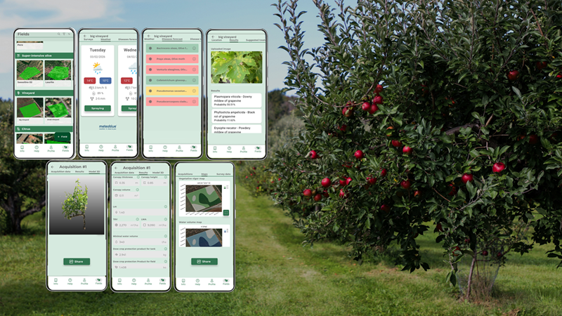
iAgro is the mobile app that brings precision agriculture into every farmer's pocket. All it takes is a smartphone photo for iAgro's AI and computer vision to reconstruct a digital twin of the crop, identifying stress, deficiencies, and targeted treatment areas, without the use of field sensors. The innovation: making a technology previously reserved for those who could afford dedicated hardware accessible to every farm. With iAgro, you can create a master file of your plots and plan field operations according to the principles of precision agriculture, supported by super-local weather and satellite indices. Recognize diseases from a photo and consult disease and insect forecasting models, soil data, and CO2 absorption. By scanning plants, you can create a 3D digital twin of your crops, with yield and vegetative vigor estimates, generating variability and prescription maps to optimize cultivation operations, and reports with AI suggestions.

iDrone - Aerial surveys and treatments for precision agriculture

iDrone - Aerial surveys and treatments for precision agriculture

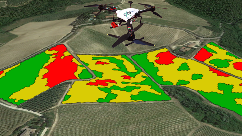
iDrone is Agrobit's aerial survey and drone application service that provides a complete map of crop health: vegetative vigor, water stress, plant counts, failures, and identification of diseased or weedy plants. ENAC-certified pilots operate RGB, multispectral, and thermal drones, from single plots to areas spanning hundreds of hectares. The innovation lies in completing the entire cycle with a single supplier: from raw data to variable-rate prescription maps, to the aerial distribution of liquids, granules, foliar fertilizers, and beneficial insects for biological control using spraying drones. The prescription maps are sent to variable-rate machinery, or adapted to standard machinery, to automatically adjust fertilizer, water, and pesticide doses based on the actual variability of the field. This end-to-end workflow—survey, analysis, prescription, and distribution—reduces waste, time, and chemical inputs.

Our video